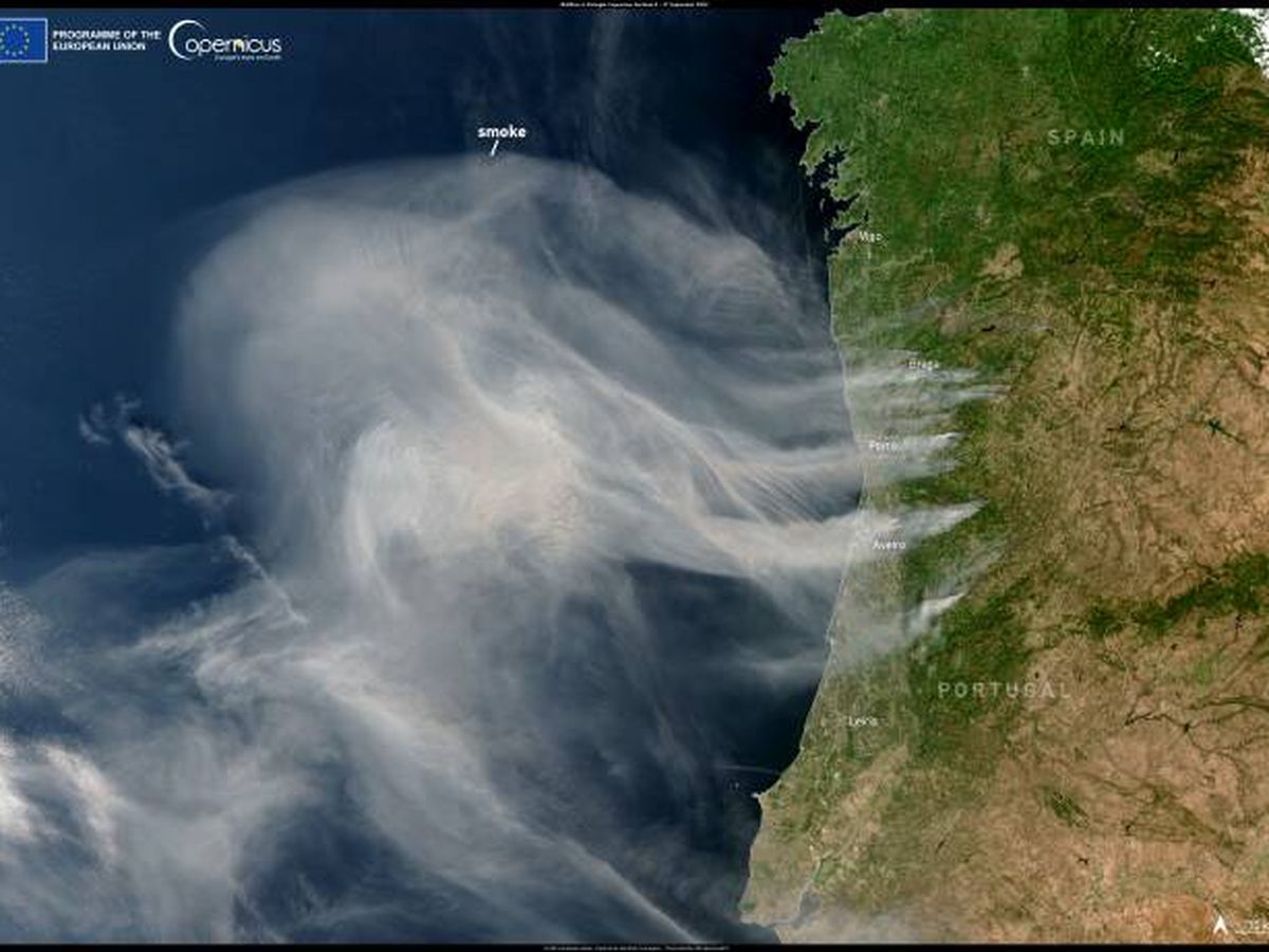
AN incredible photo taken from space shows the 100-plus forest fires that are currently ravaging Portugal.
The inferno has continued to advance since being declared on September 14, and more than 10,000 hectares of land have been destroyed.
The flames have taken hold in the regions of Porto and Aveiro, in the north and centre of the country, and the smoke is now beginning to enter Spanish territory.
The columns of smoke were pictured by the EU’s Sentinel-3 satellite, which forms part of its Copernicus space programme.
The cloud of smoke covers 100,000sqkm over the Atlantic Ocean, and has even reached parts of northern Spain, sparking concern among locals.

More than 5,000 firefighters are tackling the inferno on the ground, including more than 200 troops sent from Spain.
The EU has also deployed firefighting aircraft from France, Italy, Greece and Spain as part of its Civil Protection Mechanism.
Portugal has already declared a disaster zone in several of the affected areas.
At least seven people have been killed, including three firefighters, while another 50 are injured.
Hundreds of people have been evacuated from their homes, with many towns reduced to ashes.
The smoke has been entering Spain in Galicia and Asturias, with health authorities there advising anyone with breathing problems to take precautions.
State weather agency AEMET has warned that different smoke particles from the fires in Portugal will cause ‘some darkening’ of the skies above Extremadura over the next few days.
The weather has provided the perfect conditions for the fires to grow, experts said, with temperatures of up to 30C and humidity below 30%, plus winds of 30km/hr.
The ‘perfect recipe’ for a devastating fire is known as the 30-30-30 rule.
It is hoped that expected rains this weekend will help bring the fires under control.
Click here to read more Spain News from The Olive Press.


