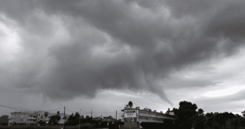
FURTHER yellow and orange warnings for severe rain and thunderstorms have been issued across Malaga.
It comes after AEMET raised another set warnings last night lasting until 6pm today, triggering the Ayuntamiento de Malaga to activate an emergency plan.
Tha Antequera and Ronda areas are under yellow alert, while the Costa del Sol, Axarquia and Guadalhorce face orange warnings.
https://www.facebook.com/susana.chraibimartin/videos/pcb.10215640653761438/10215640653521432/?type=3&theater
Shocking images circulating on social media show how the lashings of rain have already left numerous streets flooded in Malaga city centre, Torremolinos and Mijas today.
According to AEMET up to 180 litres per square meter will fall over 12 hours.
? Precaución: LLueve con fuerza en algunas zonas de #Málaga capital.
Imágenes de la calle Ollerías.#Lluvias #Tormenta #FMA pic.twitter.com/PobKz2A4xY— Málaga Urgente (@MalagaUrgente) October 18, 2018
A so-called “cold drop” – a sudden fall in temperatures along the east coast caused by the arrival of cold polar air – is typical in Autumn in the Mediterranean, AEMET spokesperson Rubén del Campo told El Pais, but a drop this severe has not occurred since October 2008.
Andalucia, along with the Balearic Islands, Murcia, Valencia, Catalunya and Aragon are predicted to be the worst hit regions in Spain.


